Catalog Archive
Auction 114, Lot 244

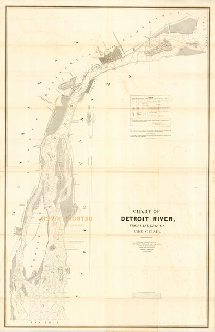
"Chart of Detroit River from Lake Erie to Lake St. Clair. Surveyed 1840, 41, & 42 by Lts. J. N. Macomb and W. H. Warner", U.S. War Department

Subject: Michigan

Period: 1842 (dated)

Publication: Sen. Doc 401, 28th Cong., 1st Sess.

Color: Black & White

Size:
29.3 x 46.3 inches
74.4 x 117.6 cm
Download High Resolution Image
(or just click on image to launch the Zoom viewer)

Very detailed map that was produced under the Direction of Captain W.G. Williams. The map is filled with detail including the islands of Hog, Grosse and Fighting, and town plans for Sandwich, Truago, Gibraltar and Amherstburg. It further delineates areas of overflow, the roads and towns along the river's banks from Detroit to Truago Islands, and more. The detailed plan of Detroit shows numerous roads and other details including the roads to Chicago and to Saginaw.

References:

Condition: B

Issued folding, now pressed and backed with archival tissue. Dark offsetting from title, else a very nice example.

Estimate: $120 - $160

Sold for: $90

Closed on 3/1/2006

Archived