Subject: Colonial Florida and Bahamas
Period: 1775 (dated)
Publication: West India Atlas
Color: Black & White
Size:
24.5 x 19 inches
62.2 x 48.3 cm
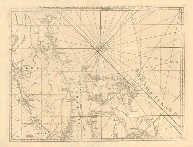
This fabulous naval chart is one of the most important maps of Florida, being the earliest relatively accurate map of the region. The hydrographic detail of the coastline and the channels in the Bahamas is excellent and it remained the standard sailing chart for the Florida seas during the last part of the 18th century. Beautifully engraved with rhumb lines and tiny ships. This is the first state with Robert Sayer's imprint at bottom. It is one sheet of the sixteen-sheet map of the West Indies that formed the heart of this important Revolutionary War period atlas. Sheet number DG.4 printed at upper right.
References: Sellers & Van Ee #1608; Stevens & Tree #26.
Condition: B
Fine impression printed on sturdy paper. Some minor repairs near centerfold, including a bit of facsimile of a couple of Rhumb lines. The imprint at bottom was lightly printed and has been traced over in blank ink.