Subject: District of Columbia
Period: 1915 (dated)
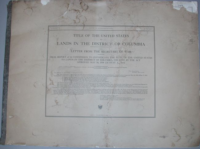
Publication: HR Doc. No. 1055 64th Cong., 1st Sess.
Color: Printed Color
Size:
32 x 24 inches
81.3 x 61 cm
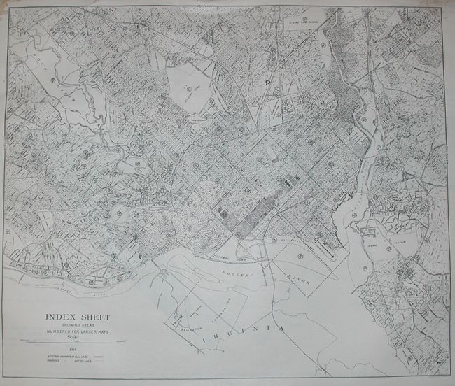
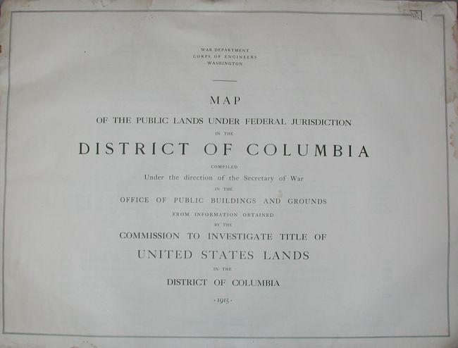
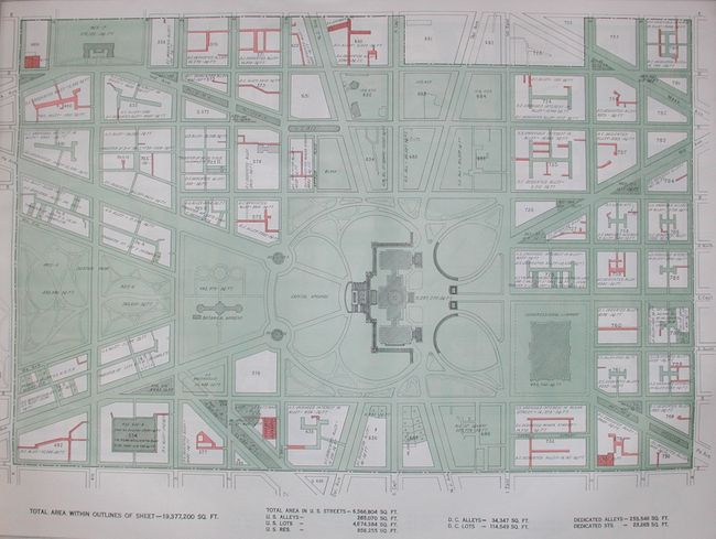
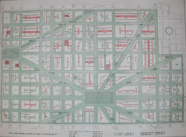
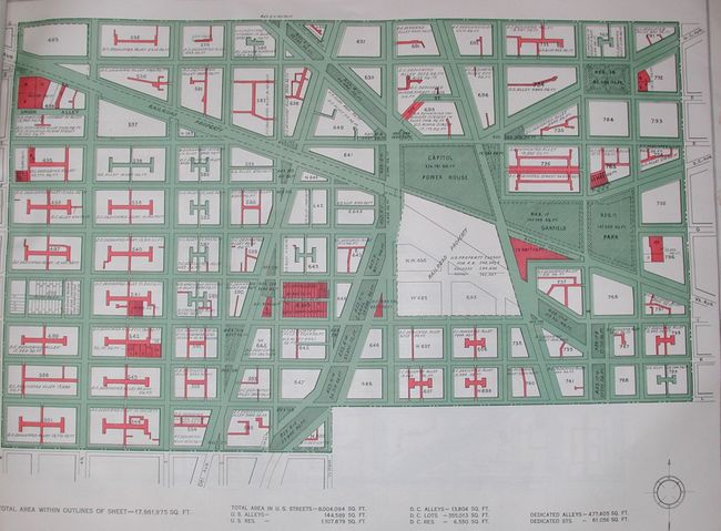
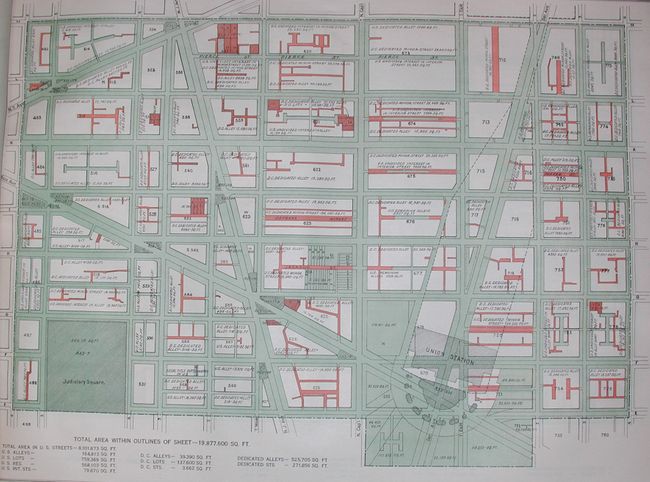
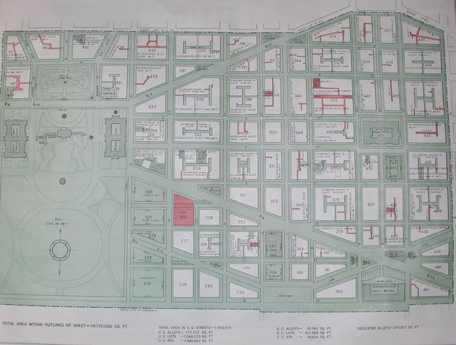
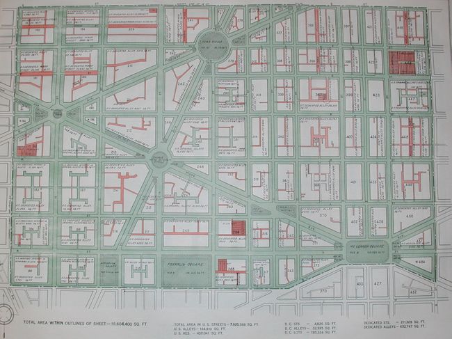
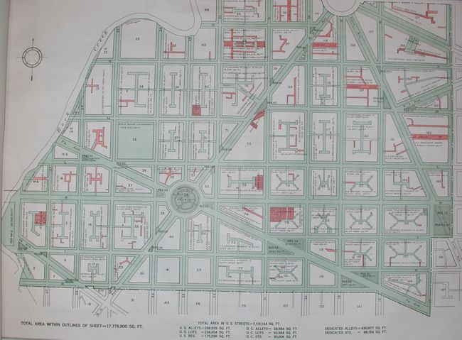
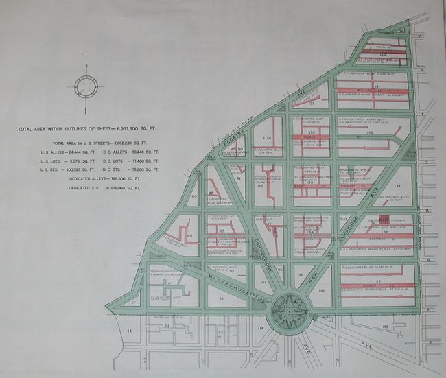
This set of maps was drawn to accompany the Report of the Commission to Investigate Title of U.S. Lands in District of Columbia. Contains title page, notes (with loss affecting border at top), Index sheet (tear into map at top), plus 41 huge maps with amazing detail. Through the use of line and color, the legend identifies alleys, streets, and lots belonging to the federal or district government. Signed in the plate by Colonel Wm. W. Harts, Superintendent Public Buildings and Grounds. The set is bound as a huge double-elephant folio atlas with printed paper wrappers. A set of remarkable maps that was likely published in a small quantity.
References: Phillips (A) 11774.
Condition: B
Paper wrappers soiled, damp stained, tears and some loss at edge. The maps are generally very good to fine with occasional toning or damp staining in margin. The first few maps have a marginal tear upper left that touches neatline.