Subject: Colorado
Period: 1869 (dated)
Publication: Colorado: It's Resources, Parks, and Prospects…
Color: Hand Color
Size:
25.8 x 18.5 inches
65.5 x 47 cm
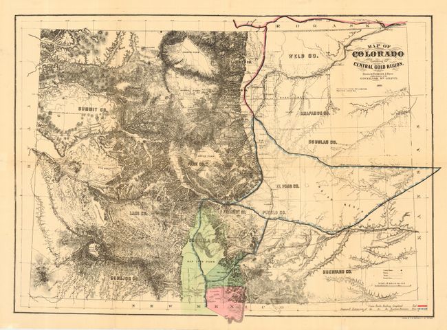
A seldom seen and early map of Colorado focusing on the central portion of Colorado and the Front Range. The map was drawn by C.W. Bacon & Co., 127 Strand, as noted at bottom right. Names South, Middle, and North Parks. Extends to show Bent's Fort, and Fort Lyon, Fort Collins, Park of the Animas, and Mesa Verde. Names the counties of Summit, Lake, Conejos, Park, Weld, Arapahoe, Douglas, El Paso, Fremont, Larimer, Boulder, Jefferson, Pueblo, and Huerfano. Legend in red and blue color locates the completed and proposed extent of the Union Pacific Railroad. Relief shown by hachure.
References: cf Rumsey 2125.
Condition: B
Good impression and original coloring. Trace of toning on some folds. A few fold lines split, well closed and reinforced on verso with archival tissue, as are all folds. A sound and nice example.