Subject: California
Period: 1865 (dated)
Publication: Whitney's Yosemite Guide Book
Color: Black & White
Size:
24.5 x 15 inches
62.2 x 38.1 cm
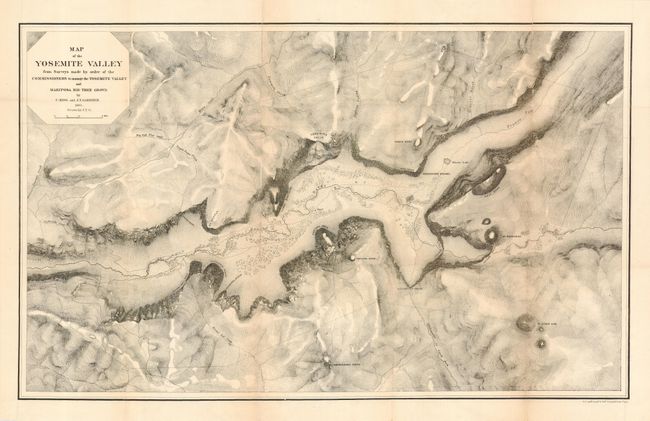
This map is a product of Whitney's California Survey. In 1864 the governor of California accepted Yosemite for the State. King, Gardner and Cotter were ordered immediately to complete a survey of Yosemite before the onset of winter. The product of their efforts, despite frightful weather, is a superb early map of the valley. Locates the Merced River, Virgin Tears, Yosemite Falls, Sentinel Rock and Dome, Bridal Veil Falls and Creek, Mariposa Trail and much more. Topographical detail via hachure. A very early and most desirable Yosemite piece. Originally published in the Commission to Manage the Yosemite Valley, 1865, this edition published in 1869.
References: Groetzmann "Exploration & Empire", p. 368-78.
Condition: B
Issued folding, now pressed and backed with archival tissue. Some fold splits with two areas of small loss at fold, other tiny tears also along folds, all well supported with backing.