Subject: Alaska
Period: 1897-1915 (dated)
Publication:
Color: Printed Color
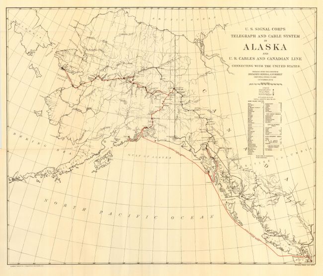
The first map is "U. S. Signal Corps Telegraph and Cable System in Alaska and U. S. Cables and Canadian Line Connecting with the United States Prepared under the Direction of Brigadier General A. W. Greely Chief Signal Officer, U. S. Army October 1904" (17 x 20.3"). Published in Wash. D.C., it uses colored lines to indicate the telegraph and cable routes from Seattle to Nome. Includes a table of all towns and villages with incremental mileage and the total of 3883 miles. The towns and post offices along the route are shown. The project connected Alaska to mainland U. S. via a communications network for the first time.
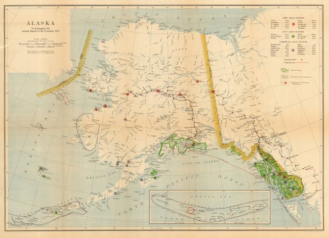
The second map is "Alaska to Accompany the Annual Report of the Governor, 1915" (16.8 x 23.7"). Based on the map from the U. S. Geological Survey. This map is the star of the lot with crisp lines and fine printed color. It locates all Army, Navy and commercial radio stations and telegraph lines. A table names the stations and gives their transmitting power. An inset map of the Aleutian Islands shows the entire chain to be within the boundary of a bird reservation.
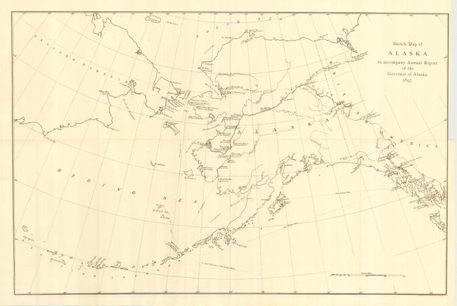
The third map is "Sketch Map to accompany Annual Report of the Governor of Alaska 1897" (14.2 x 21.8") black and white. This simple map locates churches with their denomination. Also shows reindeer stations throughout the territory, and sea mileages between ports, for example Unalaska to San Francisco is 2369 statute miles.
References:
Condition: A
All are folding, as issued. The first is fine. The second exhibits a trace of toning on two folds, still very good. The third map has binding trim nearly to border, as issued.