Subject: World
Period: 1612 (circa)
Publication: Beschryvinghe Vander Samoyeden Landt…
Color: Hand Color
Size:
11 x 6 inches
27.9 x 15.2 cm
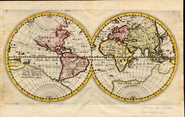
This double hemisphere map was carefully drafted to incorporate the latest discoveries. It delineates Hudson's Bay for the first time on a world map, based on Gerritsz' work on a more detailed regional map. It gives place names relating the discoveries of Hudson in the northern parts of America and to De Quiros' explorations in the Pacific. In this second state N. Albion has been added, and the Pacific coastline extends in skeleton form from N. Albion to the strait of Anian. Hessel Gerritsz was one of the truly important Dutch cartographers of the 17th century. He was cartographer to the Dutch East India Company and had access to surveys, documentation and information from Dutch colonists. A later edition of this map carried the title "Descriptio ac delineatio Geographica Detectionis Freti…"
References: Shirley #278.
Condition: A
Fine impression on hand laid paper with good margins at top and bottom. Side margins are about 1/4" outside the plate mark, apparently as issued. A little light soiling or foxing at side, map image is very good.