Subject: United States - Central
Period: 1860 (circa)
Publication: American State Papers
Color: Black & White
Size:
17.8 x 18.8 inches
45.2 x 47.8 cm
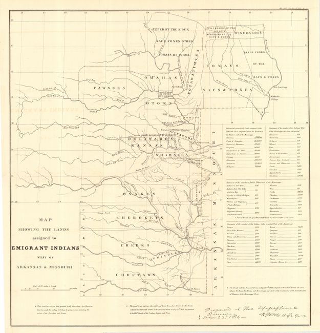
This map originally appeared in 1836 in the "Report of the Dragoons under command of Colonel Henry Dodge to the Rocky Mts. during the Summer of 1835." The expedition left Ft. Leavenworth and traveled to the Platte River and its southern fork, continuing to Bent's trading house and then back to Ft. Leavenworth. While it shows the Santa Fe Road, the route of Col. Dodge is not depicted. The tribal lands are delineated. An inset provides tabulations of the numbers of Indians and a listing of estimated acres of land assigned to these tribes. The map covers the region of present day Iowa, Nebraska, Kansas and Oklahoma. It is based on the 1835 map prepared by Lt. Washington Hood and Wheat calls it "an important historical map." This is the later issue (circa 1860) that was included in the Military Affairs Papers of the American State Papers.
References: Claussen & Friis #127; Wagner-Camp #63; Wheat [TMW] #412.
Condition: A
Folding, as issued. One fold intersection split and a hint of offsetting, else fine.