Subject: Colonial Southeast - Georgia
Period: 1737 (published)
Publication: Recueil Des Voyages
Color: Hand Color
Size:
10.3 x 7.4 inches
26.2 x 18.8 cm
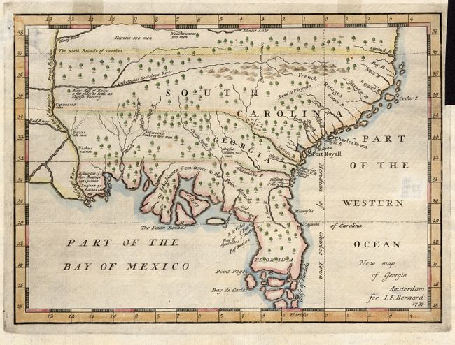
This is a scarce map that is one of the earliest published maps of the English colony of Georgia. It is a somewhat larger example that was apparently taken from the 1733 map in Martyn's Reasons for Establishing The Colony of Georgia, although with numerous errors and omissions. The map covers the region from Florida and up the east coast extending north to above the Cartuck River at the northern border of South Carolina. It extends west to beyond the Mississippi River, showing all of colonial South Carolina, Georgia and Florida. The southern portion of Florida is composed of numerous islands. Names and locates Charles Town and Port Royall, and very few other settlements. The prime meridian is drawn at Charlestown. Filled with notations including the number of men in various Indian tribes - Illinois 500 men, Weachthenoes 500 men, Okesee Nation 700 men.
References: Cumming, W.P. (SE) 234.
Condition: B
Very nice example with bright impression on hand laid paper with water mark. Two areas of paper weakness that appear to have been made during paper manufacture. Expert repair to small hole in margin. Minor tape stains in upper border.