Subject: Atlases
Period: 1670 (circa)
Publication:
Color: Hand Color
Size:
20 x 18.5 inches
50.8 x 47 cm
This composite atlas with a collection of maps of Europe and Africa was rebound in 1896, as noted on the cover. Covers are loose and no title page or list of maps is present. All maps with original full color and all by De Wit except the two noted below. The maps in this atlas include:
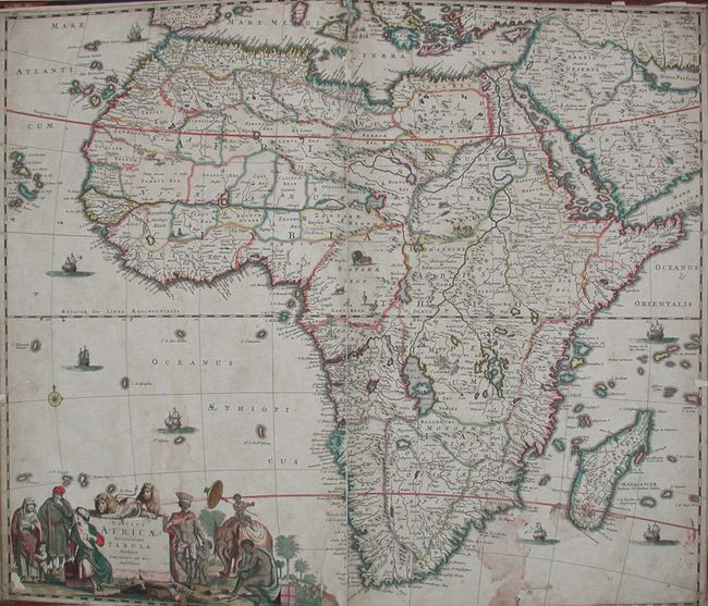
1) Totius Africae Accuratissima Tabula, stained and two tears with small loss in border;
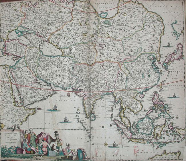
2) Accuratissima totius Asiae Tabula Recens Emendata, stains and loss to corner and small hole in ocean;
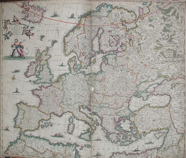
3) Nova et Accurata totius Europe Descriptio, soiled and small loose near middle;
4) Totius Regnorum Hispaniae et Portugalliae, soiled with loss to corner and near centerfold;
5) Tabula Portugalliae et Algarbia;
6) Accuratissima Galliae Tabula Vulgo Royaume de France;
7) Novissima et Accuratissima totius Italiae Corsicae, et Sardiniae Descriptio, soiled and two areas of loss near centerfold;
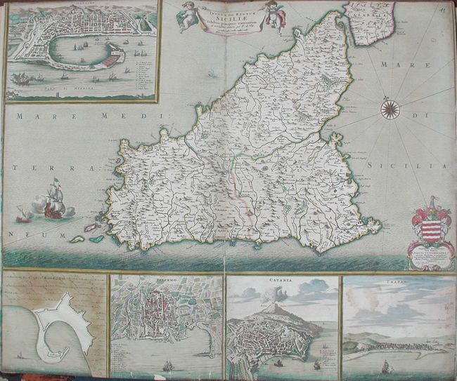
8) Insula sive Regnum Siciliae Urbibus pracecipuis exornatum, tear and slight loss at lower trim;
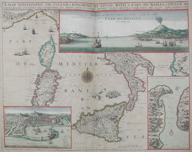
9) A Map Containing the Island & Kingdome of Sicily, with a Part of Naples, by John Sellers, 1" margins all around;
10) Insula Malta accuratissima Delineata, Urbibus, et Fortalitiis, 1" margins;
11) Insula Candia Ejusque Fortificatio, 1" margins, slight paper loss at center;
12) Nova totius Hungariae, tear at lower left into map;
13) Accuratissima Germaniae Tabula, soiled and small loss at centerfold;
14) Totius Fluminis Rheni Novissima Descriptio, 1" margins at sides and 1/2" top and bottom;
15) Utriusque Alsatiae Ducatus Dupontil, et Spriensis Espiscopatus Novissima Descriptio;
16) Novissima et accuratissima XVII Provinciarum Germaniae Inferiorus Tabula, soiled;
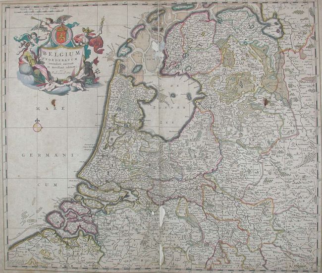
17) Belgium Foederatum emendate auctum et novissime editum, some loss along centerfold and soiled;
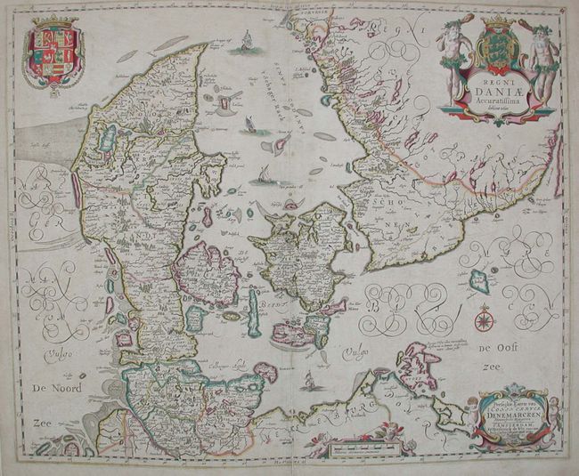
18) Regni Daniae Accuratissima delineatio, 1" margins around;
19) Scania, Vulgo Schonen, by Johannes Jansson, margins about 1" around;
20) Tabula Regnorum Sueciae et Norvegiae, 1" margins around, soiled;
21) Regni Poloniae et Cucatus;
22) Tabula Russia Vulgo Moscovia, 1" margins less at top;
23) Tabula Tartariae et majoris partis Regni Chinae, 1" margins;
24) Tabula Indiae Orientalis, 1/2" margins;
25) Nova Persiae Armeniae Natokiae et Arabiae, 1/2" margins;
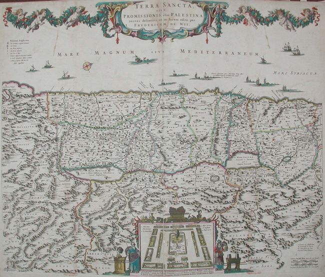
26) Terra Sancta Sive Promissionis, olim Palestina, 1/2 to 1" margins around;
27) Turcicum Imperium, stained with loss to border in a few places and lower right corner missing.
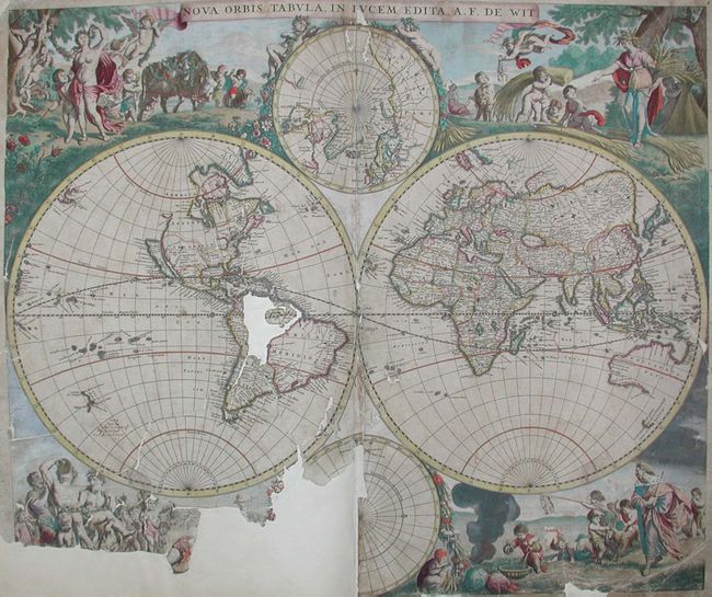
Also laid down at front is de Wit's Nova Orbis Tabula, in Iucum Edita that is in really bad condition: missing part of South America as well as a good portion of the lower left quadrant. Probably not a restorable copy. Shirley #451, first state without the cherubs in the cusps between hemispheres suggesting a date of circa 1670 for the atlas.
References:
Condition: D
Unless otherwise noted all maps trimmed to, or slightly inside, the neatline. All backed on thick 1890's paper, many with centerfold splits. Extensive restoration will be required, but the collection of map would make it well worthwhile.