Subject: Holy Land
Period: 1860 (circa)
Publication:
Color: Black & White
Size:
5.5 x 7.2 inches
14 x 18.3 cm
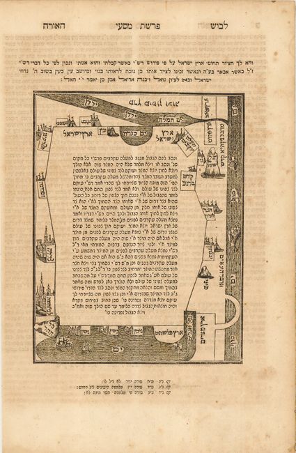
This is a very obscure nineteenth century edition of the famous map of Eretz Israel first published in 1590 by Rabbi Mordechai ben Abraham Jaffe in his monumental work Levushim. It is printed in Rashi Hebrew script in a diagrammatic format, decorated with ships in the sea and graphic depictions of the cities. The map is oriented with east at the top with the River Jordan and the Sea of Galilee. The Mediterranean Sea is at the bottom and the Sinai Desert, the Nile River and the Red Sea are on the right. Inside the map are 24 rows of text that explain the borders of the country and the cities in the possession of the twelve tribes of Israel. Maps printed in Hebrew are very rare, as few were produced and many were involved in book burnings. Hebrew text on verso.
References: Wajntraub, p. 41.
Condition: B
Minor offsetting with some foxing in margins.