Catalog Archive
Auction 113, Lot 649

"Partie Meridionale du Royaume de Portugal", Robert de Vaugondy
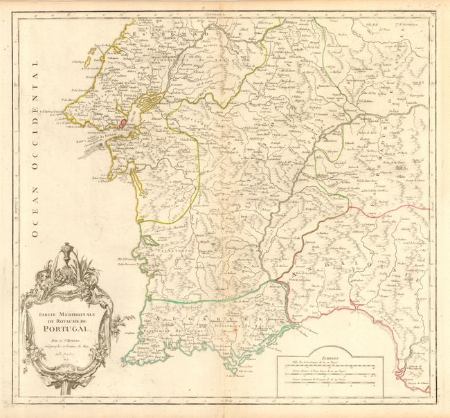
Subject: Portugal

Period: 1751 (dated)

Publication: Atlas Universel

Color: Hand Color

Size:
20.5 x 19 inches
52.1 x 48.3 cm
Download High Resolution Image
(or just click on image to launch the Zoom viewer)

This large and finely detailed chart covers the southern part of Portugal from about Torres Vedras southward. Locates the fortified city of Lisbone with scores of other place names. The map is filled with much topographical detail of mountains, rivers and political divisions and ornamented with a large title cartouche engraved in the French style.

References: Pedley #321.

Condition: B

Delicate impression with original outline color. Printed on a full sheet of thick hand laid paper with original margins and large watermark. Hint of centerfold toning, small split at top and one spot, else very good.

Estimate: $140 - $180

Sold for: $70

Closed on 12/7/2005

Archived