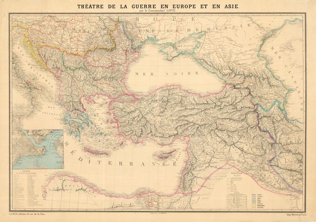
Subject: Black Sea
Period: 1856 (circa)
Publication:
Color: Hand Color
Size:
39 x 26.3 inches
99.1 x 66.8 cm
Large and impressive chart illustrating the Crimean War zone. On the map each country is colored to indicate the controlling imperial power. Centered on the Black Sea, the map extends from Italy and the Adriatic Sea east to the Caspian so it includes most of the Middle East as well. Filled with incredible detail including railroads, towns, villages, forts, etc. Nice inset of the vicinity of Constantinople including Serail, Galata, and Scutari with detail down to individual buildings. Handy legend related to the inset lists 60 buildings, but the cartographer forgot to place the corresponding numbers in the inset! Nine distance scales are given.
References:
Condition: A
Good impression and fine original color. A little roughness to margins in a couple places and a couple of short tears, well away from map image.