Catalog Archive
Auction 113, Lot 564

"Royaume de Hongrie, Principaute de Transilvanie, Sclavonie, Croatie, et partie de la Principaute de Valaquie, de la Bosnie, de la Servie et de la Bulgarie", Robert de Vaugondy, Gilles
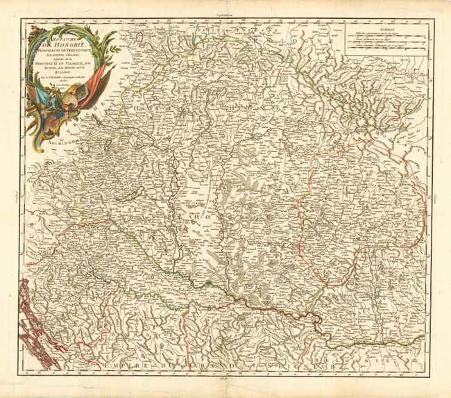
Subject: Southeastern Europe

Period: 1751 (dated)

Publication:

Color: Hand Color

Size:
21.6 x 18.6 inches
54.9 x 47.2 cm
Download High Resolution Image
(or just click on image to launch the Zoom viewer)

Copper engraved map with strong detail throughout covering primarily Hungary and Romania with parts of Croatia, Bosnia, Serbia and Bulgaria. Locates scores of towns and villages with good topographical detail as well. The Chemin de l'Empereur Trajan is shown in Romania and Fort Romain is just east of Belgrade. Decorated with a large title cartouche.

References: Pedley #288.

Condition: A+

Fine impression and color. Bit of light surface soil in bottom blank margin.

Estimate: $275 - $350

Sold for: $210

Closed on 12/7/2005

Archived