Subject: Germany
Period: 1716 (published)
Publication: Grosser Atlas
Color: Hand Color
Size:
22.5 x 19.5 inches
57.2 x 49.5 cm
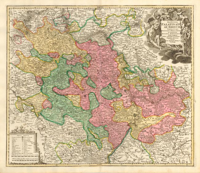
A striking regional map of Germany, centered on the Rhine River Valley, from Beinheim and Lueterburg to St. Goar and Ober Wesel, centered on Worms and Manheim. Also shows Heidelberg, Keiserslautern, Frankfurt, Maintz, Phillipsburg, Frankendahl and a host of other fortified cities. The detail continues to include roads, rivers, lakes, mountains, towns. Along the right side is Die Berg Strass or mountain route from Darmstadt to Heidelberg, a popular tourist tour today - via autobahn. Large decorative allegorical cartouche, with a military theme and a coat of arms fills the upper right and a second cartouche displays an extensive key to the map symbols and scale.
References:
Condition: A+
Very nice original color and good impression.