Subject: Guyana, Suriname, French Guiana
Period: 1751-1850 (published)
Publication:
Color: Hand Color
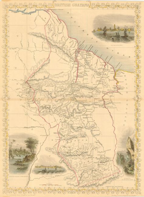
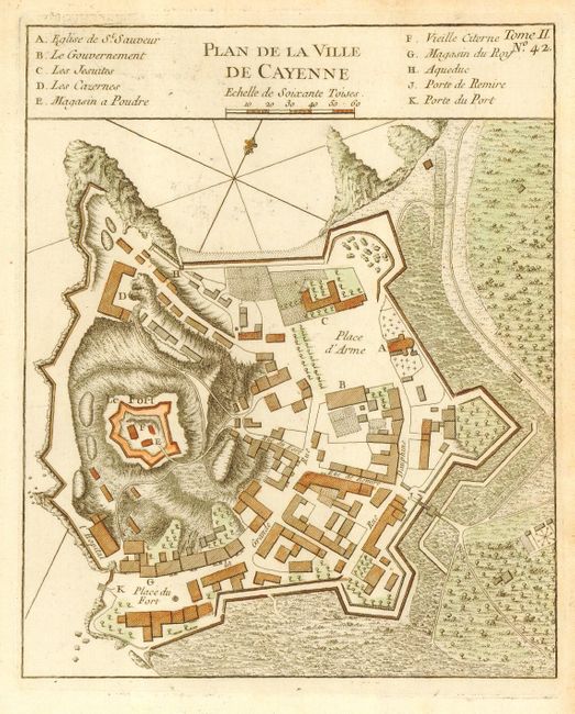
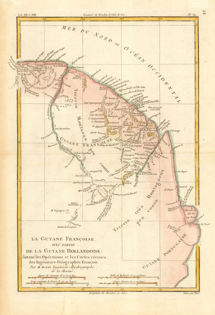
The first is a typically beautiful and finely engraved steel plate map (9.7 x 13.5") by John Tallis. There is good detail in the map and four vignettes including Georgetown, showing numerous sailing ships in the harbor, Christmas Cataract, River Berbice, Ataraipu or the Devil's Rock, and New Amsterdam. A nice example with delicately colored vignettes and borders. Published in London circa 1851 in Martin's "Illustrated Atlas and Modern History of the World." The second is an attractive copper engraved plan (7.1 x 8.7") showing the fortifications and major buildings of this important fort and natural harbor in French Guyana. Drawn by J.N. Bellin and published in Prevost's "l'Histoire generale des Voyages," Paris, circa 1753. The last chart (8.5 x 12.6") is by Bonne and was published about 1780. It covers from the mouth of the Surinam River to just below the C. de Nord. Shows the famous Devil's Island and many Indian villages. Nice trio of maps related to Guyana.
References:
Condition: A
First is a nice impression and typically close margins, lightly toned along centerfold. Second with fine impression on hand laid paper with full margins. Last has some creasing and marginal toning.