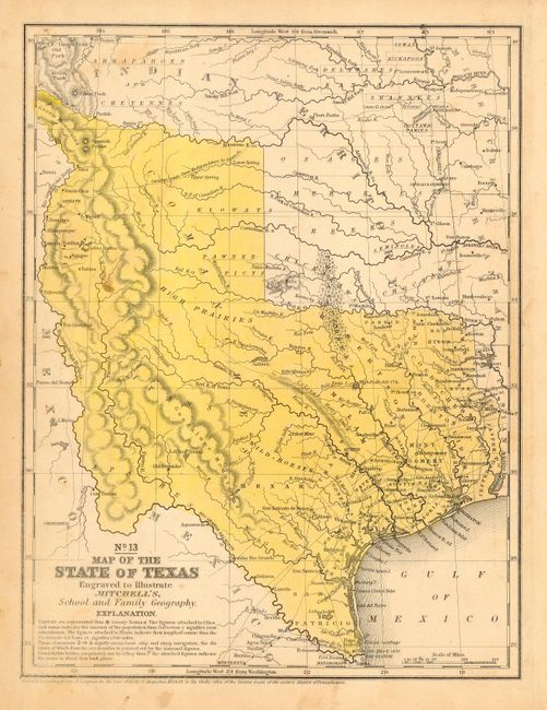
Subject: Texas
Period: 1846 (dated)
Publication: Mitchell's School and Family Geography
Color: Hand Color
Size:
8 x 10.5 inches
20.3 x 26.7 cm
First edition of this desirable map; the first to name Dallas. Texas is shown in its maximum size configuration as determined by the annexation of 1845. Texas extends north along the Rio Grande to Taos where it narrows and continues through the Green Mountains. Details include Indian tribes, watershed, counties, cities and towns, wagon roads or trails, the Caravan route from Independence to Santa Fe, and more. There are no counties formed west of approximately the 98th meridian. The Staked Plains are not noted, here the region is labeled High Prairies. The hills are shown through hachure.
References:
Condition: A
Nice original full hand coloring. A few light stains or foxing in blank areas outside of main portion of map, still very good.