Subject: California - San Francisco
Period: 1869-94 (circa)
Publication:
Color:
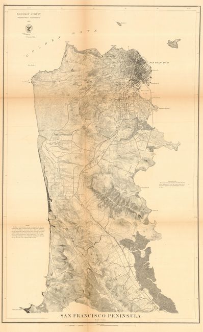
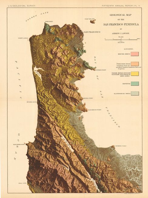
First is an excellent terrain map of the peninsula, contour intervals at 20 feet, showing interesting detail. The route of the San Francisco and San Jose Railroad is depicted from Milbrae Station north to San Francisco. Also included are a street plat of the city, Hunter's Pt., US Reserve and the Presidio, Mission de Delores, US Reserve at Black Pt., Cliff House and Seal Rocks at Pt. Lobo, etc. Published by the U.S. Coast Survey, 1869, black and white, 17.5" x 28". The latter is an amazing, near photo-realistic map that resembles today's satellite images. It was drawn by Andrew C. Lawson who used shadowing to enhance the photographic quality of this amazing map. It includes all of the San Francisco peninsula from the Golden Gate south to below San Mateo. The map measures 9.5 x 13" and was published by the U.S. Geological Survey, Fifteenth Annual Report, Plate V, ca. 1894. It is a printed color gravure by Julius Bien of New York. A nice pair detailing the vicinity of San Francisco.
References:
Condition:
Both issued folding, now pressed and backed with archival tissue. The former has toning along folds, good. The latter is very good.