Subject: North and South Carolina
Period: 1796-1809 (dated)
Publication:
Color: Black & White
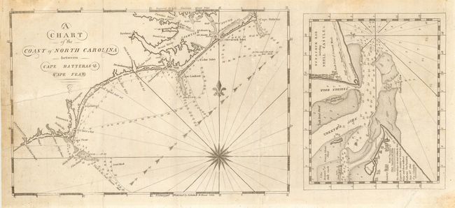
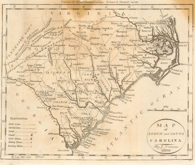
First was published by Edmund M. Blunt in the American Coast Pilot, 1809 (10.2 x 6.9"). The chart is based on the important surveys of Jonathan Price and Thomas Coles and shows the coastline with soundings, shoals and currents noted. It is printed on a sheet with a smaller (6.5 x 5.25") detailed map of Ocracock Bar including Shell Castle &c. The second map is by J. Denison for Morses Universal Geography, 1796 (9.2 x 7.4"). It is a very early American map of the region with details of roads, churches, courthouses, meeting houses, early settlements, Indian villages and boundaries.
References: #1 - Schwartz & Ehrenberg p.221; #2 - Wheat & Brun #585.
Condition: B
Both with tears into image repaired on verso with Japanese tissue. Second with stains entering map at top.