Catalog Archive
Auction 113, Lot 182

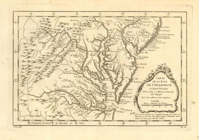
"Carte de la Baye de Chesapeack et Pays Voisins", Bellin, Jacques Nicolas
Subject: Colonial Mid Atlantic

Period: 1757 (circa)

Publication: La Petit Atlas Maritime

Color: Black & White

Size:
11.3 x 7.5 inches
28.7 x 19.1 cm
Download High Resolution Image
(or just click on image to launch the Zoom viewer)

Shows the vicinity of the Chesapeake Bay, including much of Virginia, Maryland, Delaware, southern Pennsylvania and New Jersey. Extends west to beyond Fort Cumberland and locates Annapolis, Fredericsbourg, Williamsbourg, Norfolk, and Philadelphia. Fancy rococo-style title cartouche.

References:

Condition: A

Nice impression on thick hand laid paper with wide margins. One worm hole in blank margin just inside plate mark.

Estimate: $400 - $500

Sold for: $400

Closed on 12/7/2005

Archived