Subject: United States
Period: 1859-81 (circa)
Publication:
Color: Hand Color
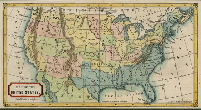
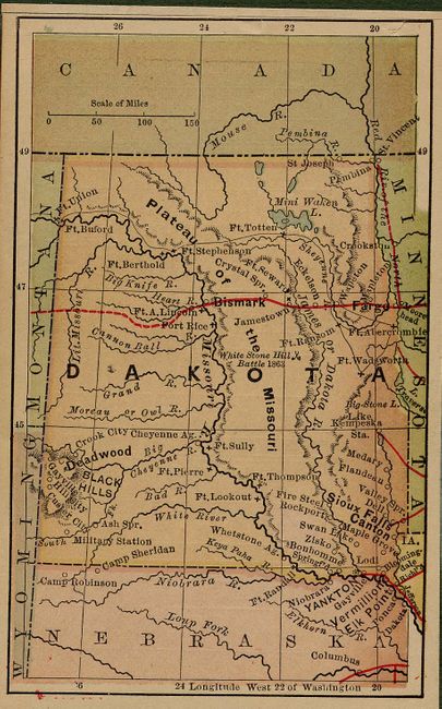
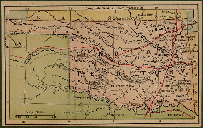
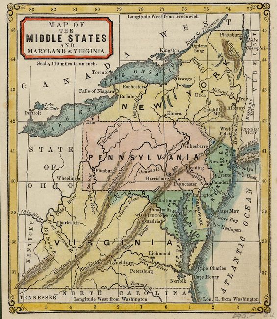
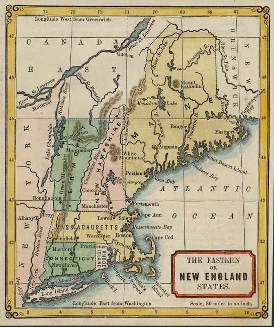
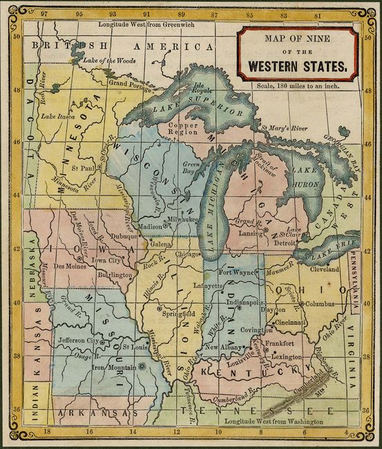
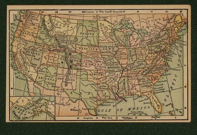
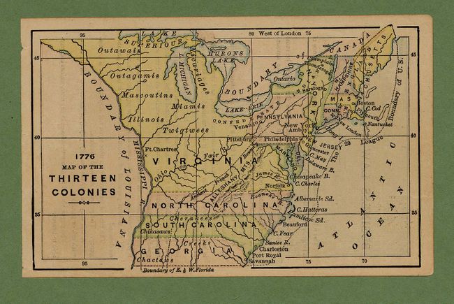
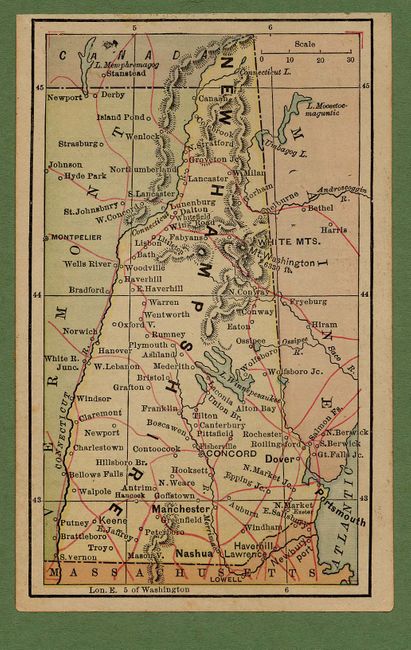
The first five are from a circa 1859 edition of Warren's New Primary Geography. Each is hand colored. The western territories have interesting borders with no sign yet of Nevada, Arizona, Idaho, Colorado, Wyoming or Montana. 1) "Map of the Territories and Texas & California" (6.3 x 5.2"). 2) "Map of the United States" (10 x 5.3"). 3) "Map of the Middle States and Maryland & Virginia" (5.3 x 6.3"). 4) "The Eastern or New England States" (5.3 x 6.3"). 5) "Map of Nine of the Western States" (5.3 x 6.3"). The remaining eleven maps were published circa 1881 in an unknown school atlas, measure approximately 4.8 x 3". All are untitled except one titled, "1776 Map of the Thirteen Colonies." The remaining maps show one state or territory per sheet and include Iowa, Kentucky, Indiana, Michigan (includes the U.P.), Arkansas, Nebraska, New Hampshire, Indian Territory, Dakota Territory, and the United States.
References:
Condition: A
Mostly fine with a few very good. All laid down on green paper or mat board for display purposes.