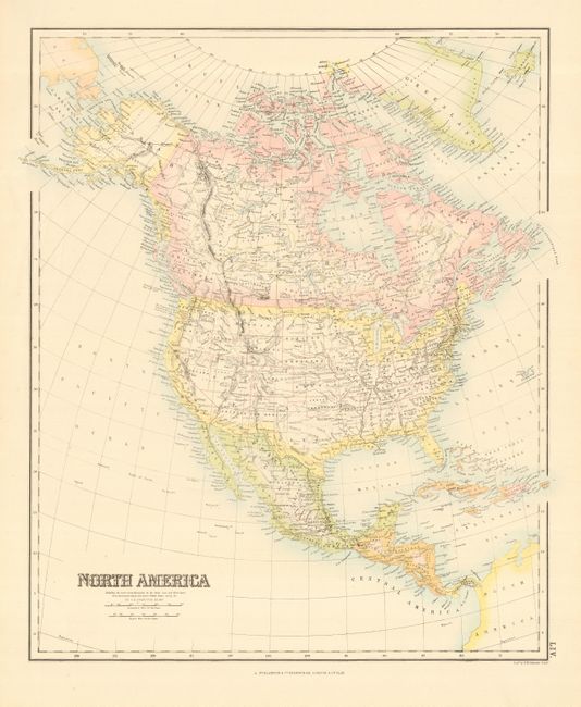
Subject: Canada and United States
Period: 1870 (circa)
Publication:
Color: Hand Color
Size:
15.7 x 19 inches
39.9 x 48.3 cm
Finely detailed map includes the state, territory and province political divisions. Alaska is noted as United States Territory and in the west most territories have achieved their final boundaries except Nevada and Arizona, which is shown with Arizona still retaining the southern tip of present-day Nevada. There is a single Dakota Territory and Indian Territory is still shown completely in the possession of the Native Americans. Western Canada is divided into Indian regions. Note below title states "Including the most recent discoveries in the Arctic Seas and West Coast, from Government charts and report, United States survey &c."
References:
Condition: A+