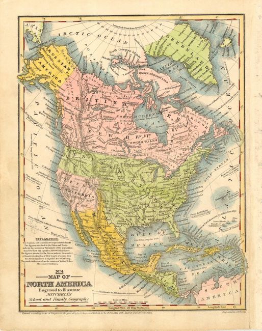
Subject: North America
Period: 1839 (dated)
Publication: Mitchell's School and Family Geography
Color: Hand Color
Size:
8 x 10 inches
20.3 x 25.4 cm
Nice map with a large Independent Texas extending to the 42nd parallel and the United States extending to the Pacific. Mexico is in control of Upper California. Alaska is Russian America with the Aleutian Peninsula labeled Alaska. Canada is depicted as British America and New Britain. States are not shown in the U.S. or Mexico. Names numerous Indian tribes, major towns with good detail of major rivers, and a vague idea of the Rocky mountains. The Great Basin is here called the Sandy Desert.
References:
Condition: B
Nice impression with original color that has been refreshed. A little scattered toning and creasing at right margin, else a very good example.