Catalog Archive
Auction 112, Lot 800

"Tables of Bearings, Distances, Latitudes, Longitude, &c, Ascertained by the Astronomical and Trigonometrical Survey of Massachusetts",

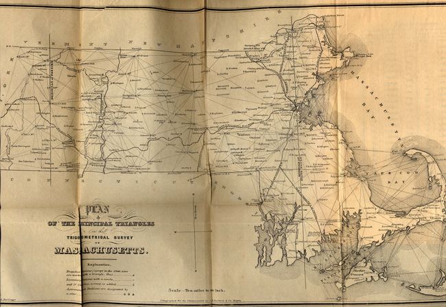
Subject: Survey Books - Massachusetts

Period: 1846 (published)

Publication:

Color: Black & White

Size:
7 x 10.5 inches
17.8 x 26.7 cm
Download High Resolution Image
(or just click on image to launch the Zoom viewer)

This book was published as a result of a resolution of the General Court by John G. Palfrey, Secretary of the Commonwealth. Complete with a folding map titled "Plan of the Principal Triangles in the Trigonometrical Survey of Massachusetts" 19.3 x 11.5, Boston, black & white. A finely rendered map that was lithographed by J.H. Bufford & Co., and drawn by F.A. Durivage. Published by Dutton and Wentworth. Hardbound with 3/4 leather and marbled boards, 73 pp. A most uncommon publication and map.

References:

Condition: A

Covers slightly rubbed, contents near fine. Map is overall evenly age toned with a few light scattered foxing spots. Owner's bookplate on inside pastedown and previous owner's stamp on blank lower area of title page.

Estimate: $75 - $100

Sold for: $140

Closed on 9/28/2005

Archived