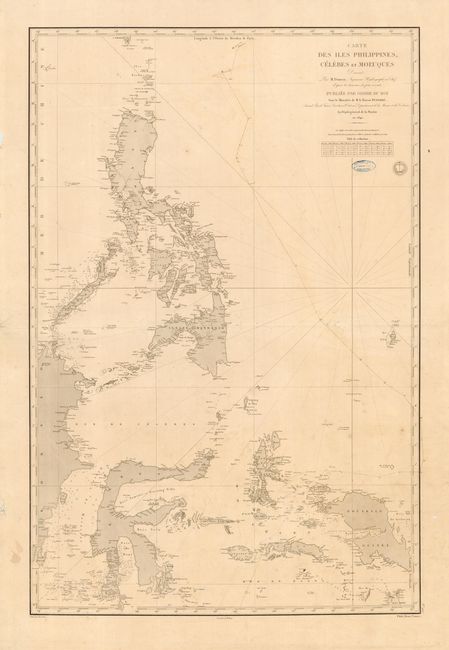
Subject: Southeast Asia
Period: 1840 (dated)
Publication:
Color: Black & White
Size:
23 x 34.5 inches
58.4 x 87.6 cm
Large-scale working sea chart detailing the Philippine Islands and the Indonesian islands between Borneo and Papua New Guinea. These are the famous Spice Islands, which remained largely a cartographic mystery until the nineteenth century as various European colonial powers attempted to dominate the spice trade in the region. This chart, drawn by Pierre Daussy, provides excellent detail of the islands, navigational hazards, etc. Ink stamp of a Paris chart seller near title.
References:
Condition: B
Light general overall soil. Two interior tears closed with archival tape. Course of a ship plotted in brown ink. Several tears in blank margins.