Subject: Asia - Eastern
Period: 1797 (published)
Publication: Atlas du Voyage de la Perouse
Color: Hand Color
Size:
19.5 x 27 inches
49.5 x 68.6 cm
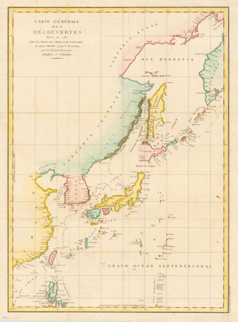
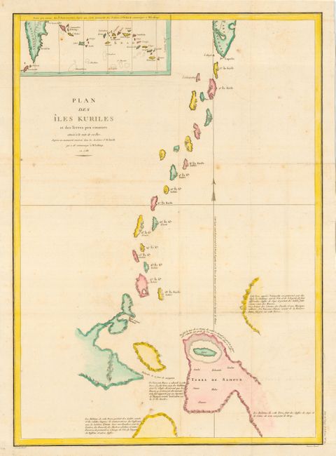
Two large-scale charts depicting the discoveries made in Northeastern Asia by La Perouse in 1787. First is a general chart covering from Kamchatka through Luzon, Philippines with great detail of the course of the expedition through the islands, and no interior details. This map is of particular interest for the information gathered by La Perouse in the region known then as Jesso and the eastern coast of Sakhalin. He discovered the passage between Sakhalin and Ezo that was later named after him. The second chart provides great detail of the Kuriles with a large inset of the Aleutian Islands.
Jean-Francois de Galoup, Comte de La Perouse commanded a French scientific expedition to the Pacific in 1785-88. Recognized as one the foremost naval commanders and navigators in France, he was selected by King Louis XVI to complete Captain James Cook's exploration of the western Pacific. After completing his explorations to this point, he sent the ship's log, and the plans and maps that had been prepared, from Kamchatka overland back to Paris. He then continued on to the South Pacific and Australia, where the expedition perished in 1788.
References:
Condition: B
Some minor foxing mostly in blank area of maps. Issued folded, now pressed.