Subject: World
Period: 1770 (circa)
Publication:
Color: Hand Color
Size:
25.3 x 18 inches
64.3 x 45.7 cm
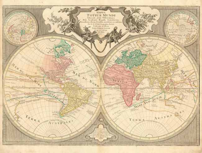
Large, handsome map based on the work of the famous French cartographer Guillaume Delisle. The northwest coast of North America is left completely blank. The routes of several important explorers and their discoveries are marked, including Magellan, Tasman, Noort, Gaytan, Quiros, and Mendana. Australia and New Zealand are only partially mapped. One of the most interesting features of the map is the appearance in the North Atlantic of the mythical island of Frislandia, which disappeared from most maps in the late seventeenth century. The map is set into an finely engraved framework with two polar spheres and a delightful baroque title cartouche featuring the allegorical female representations of the continents.
References:
Condition: B
Original color. Few scattered tiny worm holes and a bit of light soil.