Subject: Lesser Antilles
Period: 1662 (circa)
Publication: Atlas maior sive Geographia
Color: Hand Color
Size:
21 x 16.5 inches
53.3 x 41.9 cm
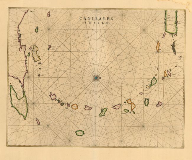
This is the first Dutch map to focus on the Antilles. It covers the Windward and Leeward Isles from Puerto Rico to Trinidad and Margarita. Centered on a compass rose with north at right, the chart is less decorative than other maps by Blaeu; having instead a practical navigational chart appearance. The title - Islands of the Cannibals - is certainly evocative. It illustrates the European impression of the mysterious islands of the New World resulting from many explorer's accounts of the savage Caribbean warriors who devoured their prisoners. Latin text on verso.
References: Goss (Blaeu) p. 162; Van der Krogt (Atlantes) 9640:2.
Condition: A
Lovely original color. Damp stain and a couple of minor old repairs in blank margins.