Catalog Archive
Auction 112, Lot 279

"The State of Rhode-Island; compiled from the Surveys and Observations of Caleb Harris", Harris, Harding

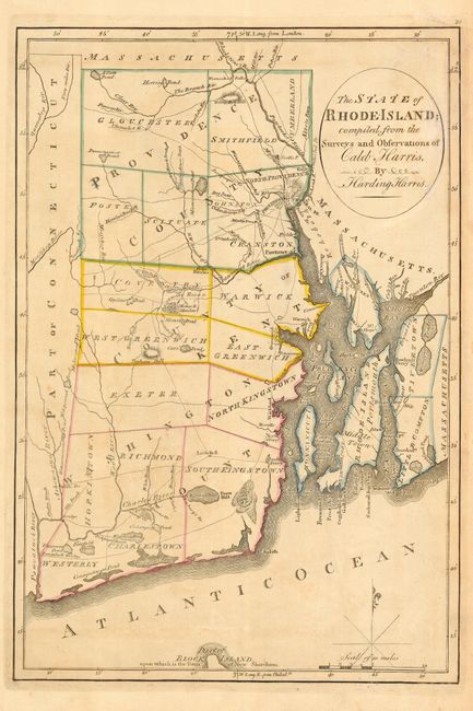
Subject: Rhode Island

Period: 1814 (published)

Publication: General Atlas

Color: Hand Color

Size:
9.5 x 14 inches
24.1 x 35.6 cm
Download High Resolution Image
(or just click on image to launch the Zoom viewer)

Great early state map showing townships and county boundaries, the main roads, principle hills and rivers. The northern tip of Block Island is shown at the bottom with the note "Part of Block Island upon which is the Town of New Shoreham." Essentially the earliest obtainable map specifically devoted to the state of Rhode Island. The map was original drawn in 1795 and then published by Mathew Carey, one of the seminal figures in early American cartography.

References: Wheat & Brun #250.

Condition: B

Original outline color. Lightly toned with a bit on minor damp staining.

Estimate: $450 - $550

Unsold

Closed on 9/28/2005

Archived