Catalog Archive
Auction 112, Lot 232

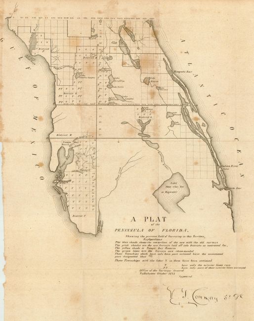
"A Plat of the Peninsula of Florida. Shewing the present field of Surveying in this Territory", U.S. State Surveys

Subject: Florida

Period: 1843 (dated)

Publication:

Color: Black & White

Size:
11.5 x 14.5 inches
29.2 x 36.8 cm
Download High Resolution Image
(or just click on image to launch the Zoom viewer)

A very scarce map showing the region from the mouth of the Swanee River south to Charlotte Harbor. Details include Tampa Reserve, bodies of water, etc. It is apparently the earliest Florida government survey, signed in the plate by V.T. Cannay, Surveyor General. Names Gilberts Bar, Indian River Inlet, Hutchinson's I., Mosquito Bar, Tampa Bay, Lake Okee-cho-bee or Bigwater, and much more. Interestingly, the legend identifies four areas by color, but this map is uncolored, as issued.

References:

Condition: B

Folding on thin but sound paper. Scattered foxing, else very good.

Estimate: $160 - $200

Sold for: $90

Closed on 9/28/2005

Archived