Subject: California
Period: 1857 (dated)
Publication:
Color: Black & White
Size:
30.5 x 20.5 inches
77.5 x 52.1 cm
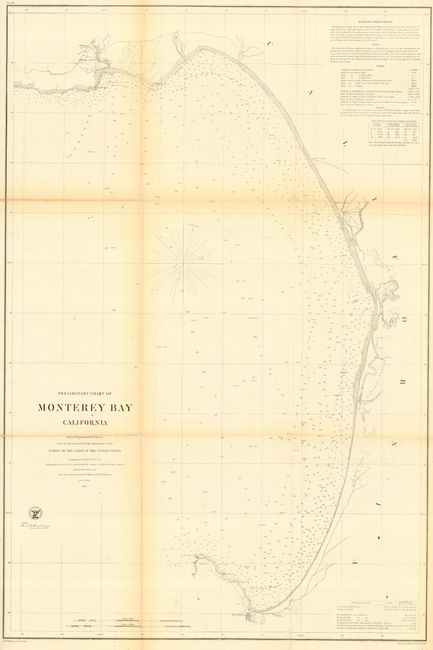
Detailed chart showing the bay with the town of Monterey at the southern extreme. Extends north to Santa Cruz, noting the location of the mission. Locates the small settlements of Hill's Landing and White's Landing. Filled with soundings and notes regarding surf along the coast. Extensive information given on sailing directions, notes and details on tides. Locates the early lighthouse at Point Pinos. From a survey by Comdr. James Alden USN with triangulation by R.D. Cutts with topography by Cutts, A.M. Harrison and W.M. Johnson.
References:
Condition: B
Folding, as issued. Split at one fold section, and toned along some folds.