Subject: South-central United States
Period: 1812 (circa)
Publication:
Color: Black & White
Size:
13.7 x 10 inches
34.8 x 25.4 cm
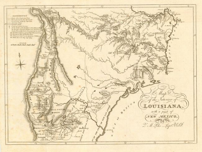
This is an interesting map of the region between the Mississippi River and the Rocky Mountains, and between the Missouri River and the Gulf of Mexico. It shows the route of Zebulon Pike's famous exploration of the Arkansas and Red Rivers and down the Rio Grande into present-day Texas and northern Mexico. The account of this journey, first published in 1810, popularized the notion of the Great American Desert and influenced U.S. officials' impressions of the region for decades. This map is identical to one published by Longman & Co. in 1811, but is without their imprint, and was engraved by Hause.
References: cf. Lemmon, Magill and Wiese #71; Wheat [TMW] pp. 11-30.
Condition: B
Folding as issued. A few light foxing spots, else very good.