Subject: United States
Period: 1844 (published)
Publication:
Color: Black & White
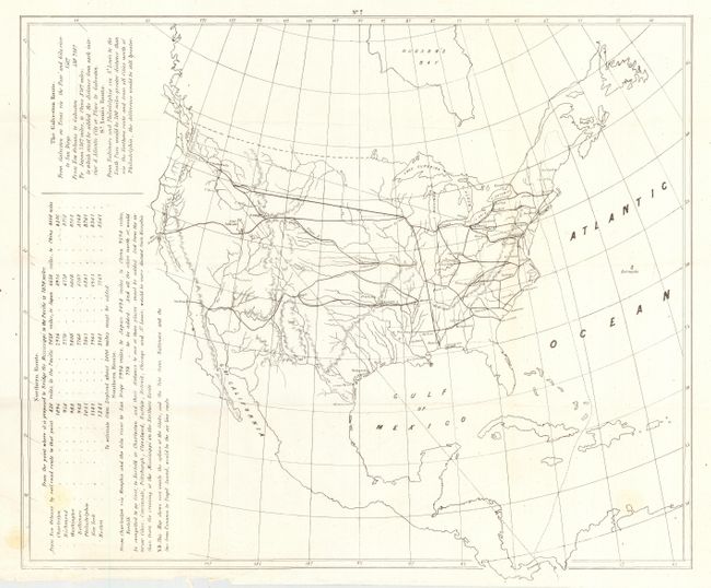
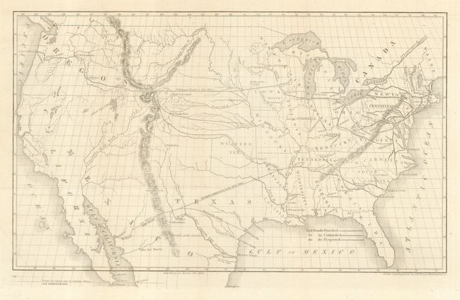
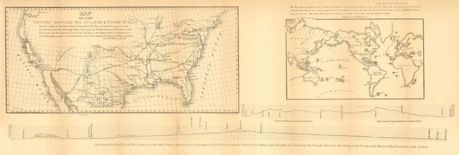
Lot of three maps relating to the development of railroads in the United States. 1) Untitled map showing the proposed RR routes to the Pacific Coast (15 x 17.5"), published in Senate Doc 69, 28th Cong., 2nd Session. 2) Untitled map showing Rail Roads Finished, Unfinished, Proposed (15.8 x 9.5"), published in HR Doc 173, 29th Cong., 1st Session. 3) Map of the Country Between the Atlantic & Pacific Oceans (33.5 x 11.6"), published in Senate Report 344, 32nd Cong., 1st Session. These three maps illustrate the efforts of Asa Whitney and Robert Mills, both men of extraordinary vision, who advocated development of the railroad routes to the Pacific, recognizing their importance to trade with the Far East. Their Memorials to Congress drew the attention of Congressional leaders and eventually led to the approval of the Pacific Railroad Surveys. It was Whitney, fully aware of the enormous cost of the enterprise, who hit upon the idea of Land Grants that ultimately provided the funding of the railroads. Map #2 has the added interest of showing an Independent Texas with the 'smokestack' configuration.
References:
Condition: A
First and second are in very good. Latter is good with some toning along folds, backed with archival tissue.