Catalog Archive
Auction 111, Lot 91

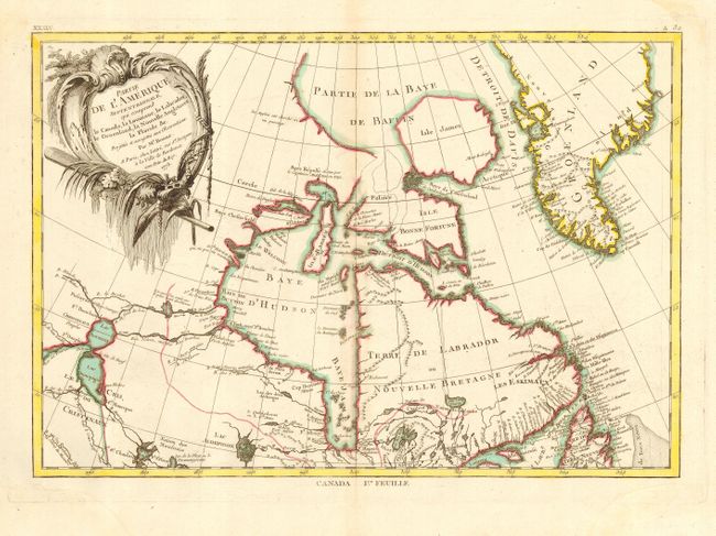
"Partie de l'Amerique Septentrionale qui comprend le Canada, la Louisiane, le Labrador, le Groenland, la Nouvelle Angleterre, la Floride &c.", Bonne, Rigobert
Subject: Canada

Period: 1773 (dated)

Publication: Atlas Moderne ou collection de Cartes sur toutes les Parties du Globe Terrestre

Color: Hand Color

Size:
17 x 11.7 inches
43.2 x 29.7 cm
Download High Resolution Image
(or just click on image to launch the Zoom viewer)

This is the top sheet of a two-part map covering eastern Canada and Greenland from the bottom of Hudson Bay, northward beyond the Arctic Circle to about 70 deg. N. latitude. It includes an interesting depiction of a passage between Lake Winnipeg and Hudson Bay alluding to a possible passage to the Pacific. Decorated with a large title cartouche. The map has full borders and stands on its own without the other sheet. Dated 1773 rather than 1771, an apparent unrecorded edition.

References: Kershaw #473; McCorkle #771.2

Condition: B

Nice impression, with good color and large watermark. Trace of toning along centerfold and slight color offsetting, also on centerfold, else very good.

Estimate: $275 - $325

Sold for: $210

Closed on 6/8/2005

Archived