Catalog Archive
Auction 111, Lot 704

"Carte du canal de Mosambique, contenant l'Isle de Madagascar avec les Cotes d'Afrique depuis le Cap de Bonne Esperance jusqu'a Melinde", Bonne, Rigobert

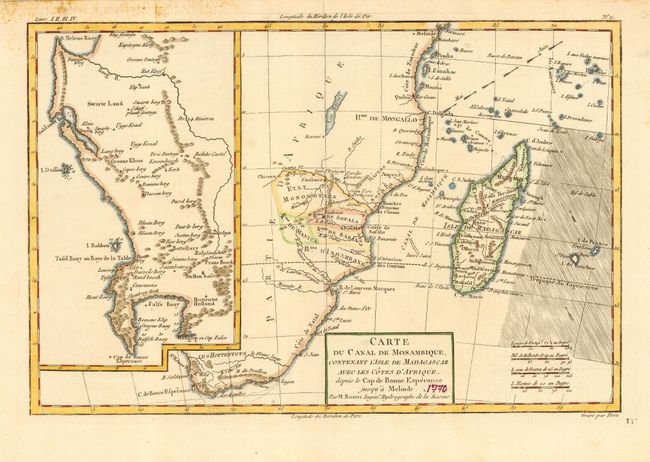
Subject: Africa - Southern

Period: 1775 (circa)

Publication:

Color: Hand Color

Size:
12.5 x 8.3 inches
31.8 x 21.1 cm
Download High Resolution Image
(or just click on image to launch the Zoom viewer)

This chart delineates the southern and southeastern portions of Africa. Extends along the coast to show the east coast nearly to the Equator. Large untitled inset details the region from S. Helens Bay to the Cape of Good Hope in the region of today's Cape Town. Good detail on Madagascar, which is shown in full. Trade winds are shown east of Madagascar.

References:

Condition: B

Nice impression and delicate hand coloring. An area of soiling in upper left margin, not affecting map image. Manuscript pen "1770" in title block, else very good.

Estimate: $70 - $90

Unsold

Closed on 6/8/2005

Archived