Catalog Archive
Auction 111, Lot 697

"A New & Accurate Map of Negroland and the Adjacent Countries, also Upper Guinea, shewing the principal European Settlements…", Bowen, Emanuel

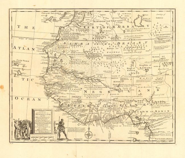
Subject: Africa - Western

Period: 1747 (circa)

Publication:

Color: Black & White

Size:
16.7 x 13.6 inches
42.4 x 34.5 cm
Download High Resolution Image
(or just click on image to launch the Zoom viewer)

Great map of West Africa filled with interesting notations concerning tribes and geographical features such as, Kingd[om] of Temian Antropohages or Men Eaters, Desart of Lumptunes Inhabited by a proud brutish people, and Country of the Ludayes which can raise 80,000 fighting Men. The coast of Guinea is labeled Grain, Tooth, Gold, and Slave Coasts with the locations of the Factories belonging to the English, French, Dutch and Danes. The title cartouche sits on the distance scales, which are in French and English leagues. Flanking the cartouche are costumed Africans, an elephant and monkeys.

References: Norwich #322.

Condition: B

Bit of minor surface soil and faint stains. Paper edge rough, but well way from map.

Estimate: $250 - $300

Sold for: $190

Closed on 6/8/2005

Archived