Subject: Africa - Western
Period: 1596 (circa)
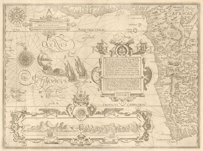
Publication: Itinerario…
Color: Black & White
Size:
21 x 15.5 inches
53.3 x 39.4 cm
This is one of the most richly ornamented maps in early cartography, superbly engraved in the Flemish style by Arnold Florent van Langren. The map covers the western coast of Africa from the Gulf of Guinea to just beyond the Cape of Good Hope with excellent detail along the coastline. The fictitious cities of Vigiti Magna and Monomotapa are located and most place names and geographical features have Portuguese nomenclature. The mainland is embellished with snakes, an elephant, a rhinoceros, a lion and a pair of sirens in Lake Zaire. The balance of the sheet is filled with fabulous cartouches, the Portuguese arms, elaborate compass roses, sailing ships and a sea monster. The large bottom cartouche encloses views of Ascension and St. Helena Islands; important refueling ports in the route around Africa.
References: Norwich 239a; Tooley MCCS No. 29, #167; Tooley et al [Landmarks] pp. 168-69.
Condition: A
Professional repairs of a couple of very tiny edge tears and along the outside fold. Good margins all around.