Catalog Archive
Auction 111, Lot 68

"Carte de l'Amerique Septentrionale et Meridionale, Ou se trouvent les Descouvertes les plus nouvelles, et les trois Voyages de Cook", Bonne, Rigobert

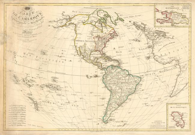
Subject: Western Hemisphere

Period: 1795 (dated)

Publication:

Color: Hand Color

Size:
30.2 x 20.5 inches
76.7 x 52.1 cm
Download High Resolution Image
(or just click on image to launch the Zoom viewer)

A very scarce copper engraved chart that shows the numerous explorations of Capt. James Cook that appears to be separately issued. Extends to include New Zealand and the many islands of the South Pacific, and to the west coast of Africa. Insets of Isle de St. Domingue and Isle de la Martinique. Very decorative lettering in title. Ten distance scales. Locates many Indian tribes, major towns, watershed and some topography. Appears to be a very scarce issue: we find no references and the only example we found is in the National Library of Australia.

References:

Condition: B

Good impression and original outline coloring on thick paper. A little occasional soiling and a few light spots. More soiling, abrasion and a tear just into map, repaired, at upper left near title.

Estimate: $300 - $400

Sold for: $275

Closed on 6/8/2005

Archived