Catalog Archive
Auction 111, Lot 670

"L'Afrique avec ses Divisions Geographiques, les Colonies Europeennes &c. &c.", Didot, P.
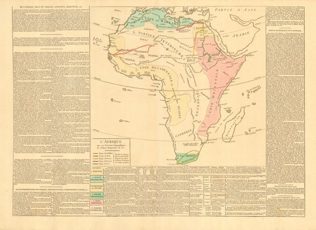
Subject: Africa

Period: 1803 (circa)

Publication:

Color: Hand Color

Size:
24 x 17.5 inches
61 x 44.5 cm
Download High Resolution Image
(or just click on image to launch the Zoom viewer)

An uncommon and interesting map depicting the European possessions throughout Africa. The map is surrounded by French text describing the history and geography of the region. The exploration routes of Mungo, Browne, Hornman, Bruce, and Vaillant are delineated with bold hand colored lines. Coloring identifies six regions and the related table gives the regions, colonial ownership, and other information. Size given includes text panels.

References:

Condition: A+

Dark impression with fine original full wash coloring.

Estimate: $160 - $200

Sold for: $120

Closed on 6/8/2005

Archived