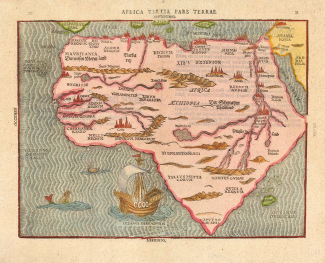
Subject: Africa
Period: 1648 (published)
Publication: Itinerarium Sacrae Scripturae
Color: Hand Color
Size:
13.2 x 10 inches
33.5 x 25.4 cm
A very rare woodcut map of the continent with an unusual shape, tapering to a point in the south. The map is on the Ptolemaic model with the Nile rising from twin lakes in the Montes Lunae and several other misplaced rivers in western Africa. Various kingdoms and cities are shown throughout including Meroe, the mythical tombs of the Nubian Kings, located on a large island in the Nile River. The surrounding seas are engraved in narrow wavy lines and include a sailing ship, merman and a sea bird. Bunting's popular theological commentary was first published in 1581.
References: Norwich #17; Tooley (MCC-29) #141.
Condition: A
Fine impression with attractive later color. Expert infilling of binding holes in top margin with skilled facsimile of a couple of letters in the title.


