Catalog Archive
Auction 111, Lot 662

"Carte de la Partie du Grand Archipel D'Asie Reconnue Par le Contre - Amiral Bruny - Dentrecasteaux; en 1792 et 1793. Levee et Dressee Par C.F. Beautemps - Beaupre", Beautemps-Beaupre, Charles Francois

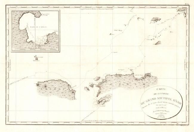
Subject: East Indies - Indonesia

Period: 1798 (circa)

Publication: Atlas du Voyage de Bruny-Dentrecasteaux en 1792 et 1793

Color: Black & White

Size:
29.6 x 19.3 inches
75.2 x 49 cm
Download High Resolution Image
(or just click on image to launch the Zoom viewer)

Rarely seen map showing, in great detail, the areas around the islands of Ambon, Ceram and Buru. The track of the ships are shown along with excellent coastal and inland survey detail. In 1792-93, at the height of the French Revolution, Admiral Bruny-d'Entrecasteaux led the search for the lost expedition of La Perouse. The expedition ended in the East Indies amid open clashes between the Royalists and the Republicans in the crew after the death of D'Entrecasteaux from scurvy.

References:

Condition: A

Dark impression on thick hand laid paper with full margins. Issued folding, now pressed. Trace of toning along one fold.

Estimate: $120 - $180

Sold for: $75

Closed on 6/8/2005

Archived