Subject: India and South East Asia
Period:
Publication:
Color: Hand Color
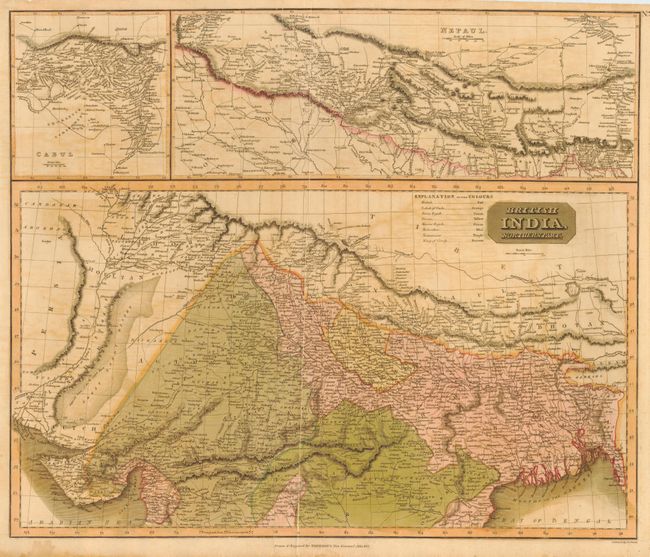
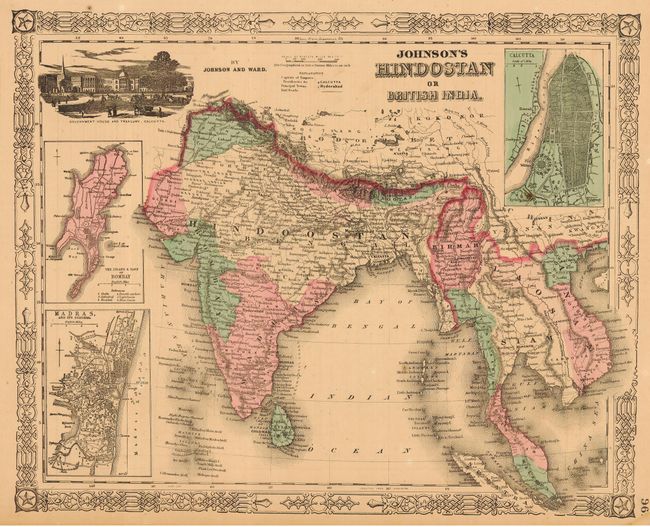
First (23.5 x 19.7") is a large map from Thomson's New General Atlas, dated 1817. The map covers northern India with an amazing amount of detail. Two large insets at top cover Cabul and Nepaul. The original color distinguishes the British and Indian Rajahs. The second map (15.7 x 12.6") by Johnson and Ward is from the Illustrated Family Atlas of the World, circa 1863. It covers the region from India to Vietnam and south to Malaysia and Singapore. Includes insets plans of Bombay, Madras and Calcutta and a vignette of the Government House and Treasury, Calcutta.
References:
Condition: B
Both lightly toned. Thomson map with light offsetting and a crease reinforced with archival tape. Remnants of hinge tape on versos.