Subject: Japan
Period: 1740 (circa)
Publication:
Color: Hand Color
Size:
23.7 x 18.5 inches
60.2 x 47 cm
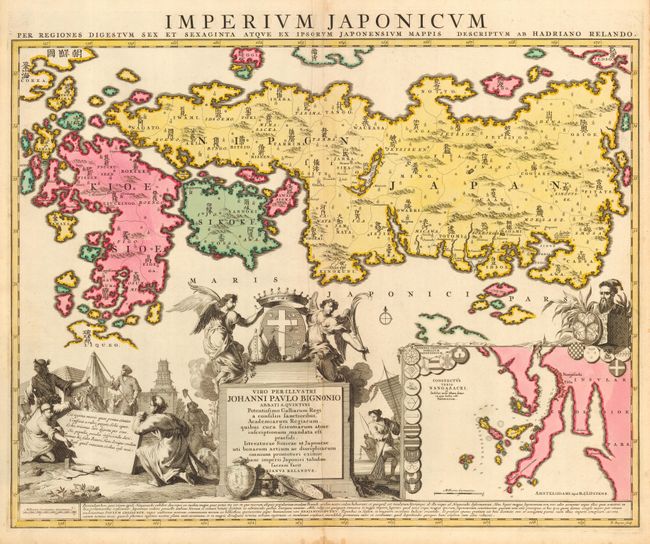
Lovely map of Japan with a large inset of the vicinity of Nagasaki and two large, decorative cartouches. This map was based on two sources: a manuscript by a Dutchman indicating the details of the coast, and from a Japanese woodblock map from the library of Benjamin Dutry, a prominent Dutch East India Company official. The woodblock map gave the provinces of Japan, naming each with their Japanese characters. This is the first Western map to include Sino-Japanese characters. The large cartouches are embellished with well rendered figures dressed in traditional Japanese attire, a Samurai, merchants, a farmer with an ox, a fisherman with nets and a boat, Japanese ceramics, and architecture. Above the center cartouche are two winged angels. Reland was an Orientalist at the University of Utrecht. The map engraved on copper by B. Ruyter and first published by Reland in 1715; this being the later edition published by Ottens.
References: Walter #68, OAG 73
Condition: A
Beautiful coloring and fine impression. A couple tiny spots and soft crease along centerfold, else fine.