Subject: Western Hemisphere
Period: 1696 (circa)
Publication:
Color: Hand Color
Size:
21 x 17 inches
53.3 x 43.2 cm
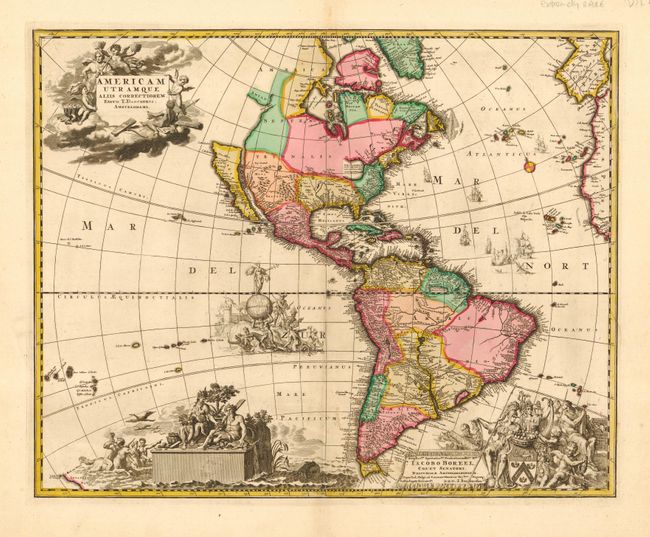
This is a stunning and extremely rare map of North and South America. Cartographically based on Visscher's influential map with the large open lake in the Great Lakes region and California is shown as an island, on the Briggs model, but with a broader northern coastline. The cartouches and other decorative elements are apparently original. At upper left is the title cartouche with the imprint of T. Danckerts, which is set in a cloud background surrounded by putti and a female representation of America. There is evidence of a privilege imprint below that has been erased from the plate. At lower right is a dedication cartouche honoring Amsterdam's mayor Jacob Boreel with the imprint of Joachim Bormeester. In the South Pacific are two elaborate allegorical scenes and in the North Atlantic are several sailing ships including a sea battle.
Theodore Danckerts (1663 - c1727) was the grandson of Cornelis Danckerts, the founder of the prominent Amsterdam publishers. Between 1680 and 1700 he produced a number of atlases, which are now very rare. Joachim Bormeester was an engraver, printer and publisher in Amsterdam also during this same period. We can find no reference of Danckerts and Bormeester working together, except for their imprints on this map. Jacob Boreel was the mayor of Amsterdam in 1696. We have not been able to find any record of this map being on the market or in any reference, although we have confirmed that it will be in Philip Burden's upcoming book. A map by Gerard Van Keulen (McLaughlin #131) is a later state of this map.
References: cf McLaughlin #131.
Condition: A
Fine impression and original color. Slight soil on centerfold, else very fine. Professional repair in bottom margin, well away from map.


