Subject: Western Hemisphere
Period: 1694 (circa)
Publication:
Color: Hand Color
Size:
21 x 18 inches
53.3 x 45.7 cm
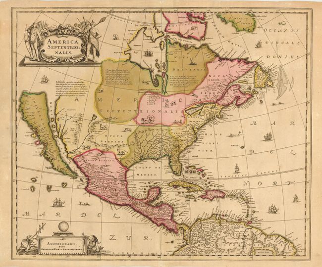
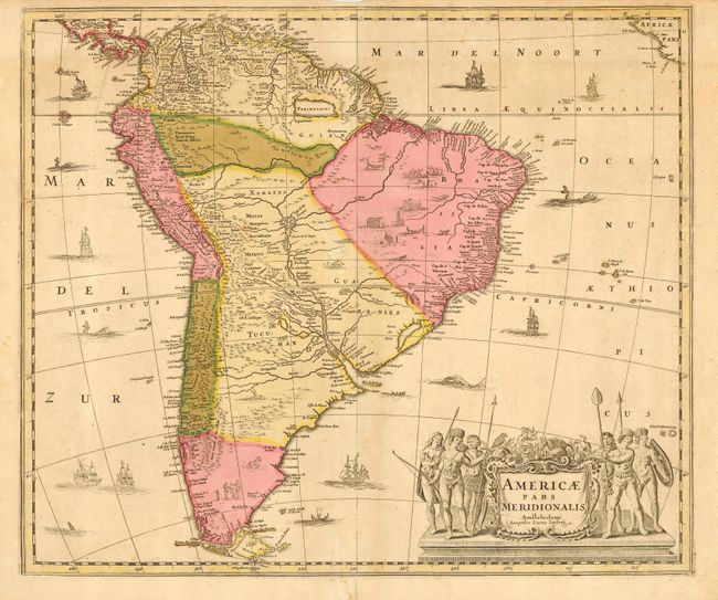
Matched pair of superb maps covering the Americas. The map of North America was one of the most influential maps in perpetuating the theory of California as an island. It is a careful compilation of various sources. The insular California is derived directly from Henry Briggs. The cartography of the Gulf of Mexico and Florida is based on Hessel Gerritsz. On the east coast the region identified as Novum Belgium is greatly elongated, Iames Towne and a few place names from John Smith's map appear in Nova Anglia. There is a single Lac des Iroquois in the Great Lakes region. In the west the Rio del Norto originates in a large western lake and flows incorrectly into the Mare Vermio. The map of South America is equally important in the cartographic history of the continent. The coastlines are well detailed but the interior is filled with spurious information. Several rivers (including the Amazon and Paraguay) all have their source in the Lago de los Xarayes. The mythical Parime Lacus dominates the interior of Guyana. The maps are richly embellished with ships and sea monsters in the oceans and vignettes of villages and animals on the continent. The large cartouche features natives, mermaids and indigenous animals.
These maps, first issued by Hondius in 1636, appeared in the Hondius/Jansson atlases until Jansson's death in 1664, when they were inherited by Johann Jansson van Waesberge. They were occasionally published in some composite atlases until the copper plates were acquired by Petrus Schenk at a public auction from the heirs of Jansson van Waesberge. These later issues are very uncommon. The map of North America includes Schenk & Valk's imprint and the map of South America has Jansson's imprint.
References: North America - Burden #245; Manasek #47; McLaughlin #6.
Condition: B
Good impressions and full original color. Maps have been professionally backed with light Japanese tissue to stabilize and replace minor losses due to oxidation of the green colored areas. Work was done by a highly skilled conservator.