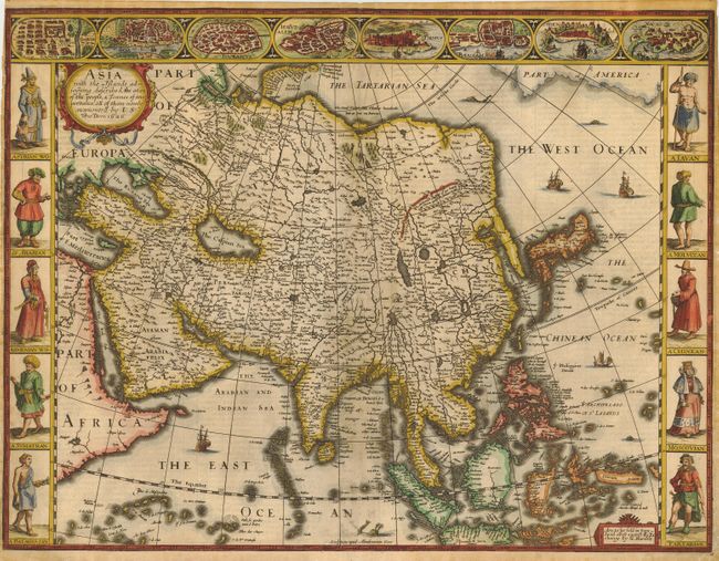
Subject: Asia
Period: 1626 (dated)
Publication: A Prospect of the Most Famous Parts of the World…
Color: Hand Color
Size:
20.2 x 15.5 inches
51.3 x 39.4 cm
The first English printed map of Asia and a beautiful carte-a-figures map, flanked by costumed figures of Asian peoples. A series of eight city views forms a decorative frieze across the top including Damascus, Jerusalem, Aden, Hormus, Goa, Kandy, Banten and Macau. The map is based largely on Jodocus Hondius' s map of 1623 with detailed depictions of the East Indies, the Philippines and the peninsular form of Korea. The map is further embellished with a title cartouche, numerous sea creatures and sailing ships. Beautifully engraved by Abraham Goos. First edition with the imprint of George Humble, published in 1627.
References: Yeo #30.
Condition: B
Sharp impression and attractive later color. Expert repairs in left border and a few worm holes have been professionally infilled near bottom border with minor facsimile of neatlines.


