Subject: Ancient World
Period: 1648 (published)
Publication: Itinerarium Sacrae Scripturae
Color: Hand Color
Size:
14.3 x 10.1 inches
36.3 x 25.7 cm
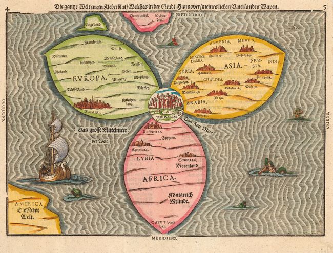
This is one of the most fanciful maps of the Old World representing the Trinity. The three continents of Europe, Asia and Africa are arranged in the form of a clover leaf with Jerusalem at the center. Three landmasses lie outside the trefoil: England and part of Scandinavia above, and in the lower left corner a portion of the New World (Die Newe Welt). The woodblock map is beautifully engraved with waves in the oceans that are filled with sea monsters, a sailing ship and mermaids. Heinrich Bunting was a theological commentator from Hanover and devised the curious shape of the map from the arms of his home town.
References: Shirley #142; Manasek #32; Laor p.129; Nebenzahl (HL) pp. 88-89; Tooley (MCC-1) #88.
Condition: A+
Very sharp impression. Professional repair of a couple of binding holes in top margin. Attractive later color.