Subject: Oklahoma
Period: 1883 (dated)
Publication: Senate Doc 17, 48th Cong., 2nd Sess.
Color: Printed Color
Size:
32.2 x 24 inches
81.8 x 61 cm
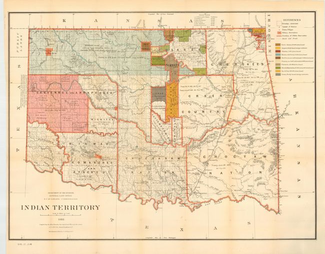
A detailed and informative map showing locations of tribal Indian lands, color coded to illustrate status of leased lands. Indian removals from their home lands, began as early as 1817 and in the years following many of the principal eastern Indian tribes were relocated to the Indian Territory forming the Five Civilized Tribes. The map reflects the additional settlement of many more tribes in the territory and provides some data on the pertinent treaties involved. Of particular interest is the Cherokee Strip, noting that its 6 million acres were leased to the Cherokee Live Stock Association [no date] and ceded to the U.S. by the Cherokee nation in 1866. The map does not include the panhandle, which by this time are Public Lands. Drawn by G. P. Strum.
References:
Condition: B
Issued folding, now pressed and backed with archival tissue. Lightly toned along some folds, else very good.