Catalog Archive
Auction 111, Lot 233

"New Rail Road and County Map of Montana and Northern Idaho", Cram, George F. & Company

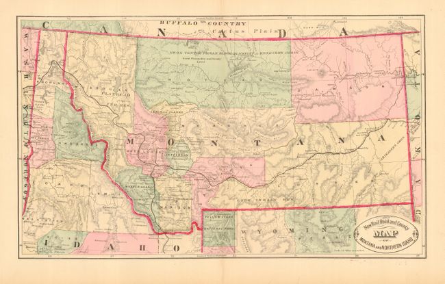
Subject: Montana & Idaho

Period: 1882 (published)

Publication: Illustrated Family Atlas

Color: Hand Color

Size:
18.4 x 11 inches
46.7 x 27.9 cm
Download High Resolution Image
(or just click on image to launch the Zoom viewer)

Terrific early hand colored map by Cram just before he turned to printed color maps using the wax engraving method. Map includes Idaho north of Payette and names several gold mining areas including Robinson Bar and Atlanta. The Pacific railroad crosses Montana and connects with a track coming up from eastern Idaho. Includes a small portion of northern Wyoming to include all of Yellowstone National Park. Excellent detail of watershed and topography, towns and forts. Oval title cartouche.

References:

Condition: A

Nice, original coloring and wide margins. A few short marginal tears and split on lower centerfold.

Estimate: $80 - $100

Sold for: $50

Closed on 6/8/2005

Archived