Catalog Archive
Auction 111, Lot 212

"[Lot of 2] Congressional Map of the State of Kansas [and] Map of Kansas - Published by the State Board of Agriculture", Rand McNally & Co.
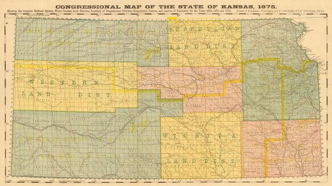
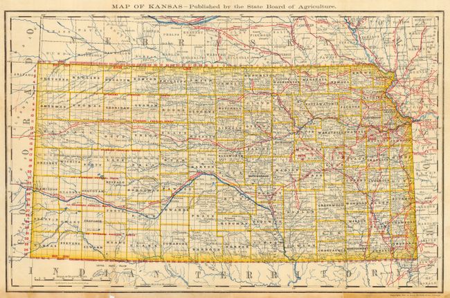
Subject: Kansas

Period: 1875-79 (dated)

Publication:

Color: Printed Color

Size:
See Description
Download High Resolution Image
(or just click on image to launch the Zoom viewer)

A nice pair of Kansas maps and early examples of Rand McNally work. The first map's title continues "Showing the complete Railroad System, Water Courses, Land Districts, Boundary of Congressional Districts, Geographical Centers of Population for the Years 1860, 1870 and 1875 (21.7" x 11.3"). Circles overprinted in red give the distance from Topeka in 20 mile increments. The other map is a fine county map that is filled with details and nicely colored (19" x 12.2"). It shows the center of population in 1878 in Morris county.

References:

Condition: B

The former with a clean tear at center, closed on verso with archival tape. The latter has a little staining at bottom margin and very short splits just to neatline.

Estimate: $100 - $140

Sold for: $130

Closed on 6/8/2005

Archived